See the Unseen. Save the Unforeseen.
For UG Contractors and Utility Companies, Every Dig is a Calculated Risk. But What if You Could Eliminate the Guesswork?
Striking an underground utility is more than just an inconvenience; it’s a significant blow to your project’s timeline, budget, and safety. The costs aren’t just in the immediate repairs. They snowball into project delays, regulatory fines, legal liabilities, and damage to your hard-earned reputation.
Consider the staggering financial impact: In 2019 alone, excavation-related damages to underground utilities cost the U.S. an estimated $30 billion. This figure encompasses everything from direct repair expenses to the cascading costs of business interruptions and medical bills. For every dollar spent on direct repairs, the indirect and social costs can be up to 29 times greater.
The problem often lies in outdated, inaccurate, or incomplete utility maps. Traditional locating methods provide a point of data, but they don’t offer a comprehensive, real-world view. This is where Augmented Reality (AR) Capture changes the game.
From Uncertainty to Certainty: Visualize Before You Excavate
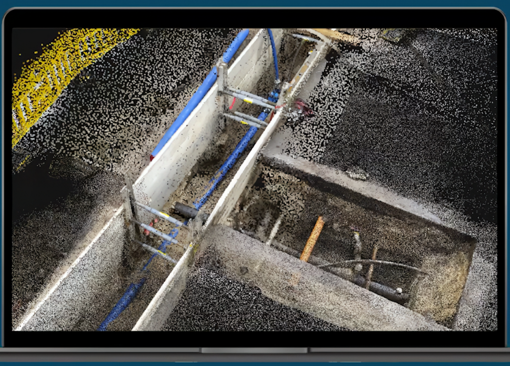
Our cutting-edge AR technology is not just an incremental improvement; it’s a paradigm shift in subsurface utility management. We transform your existing GIS, CAD, and SUE data into a dynamic, 3D map of pipes and cables, overlaid directly onto your worksite in real-time.
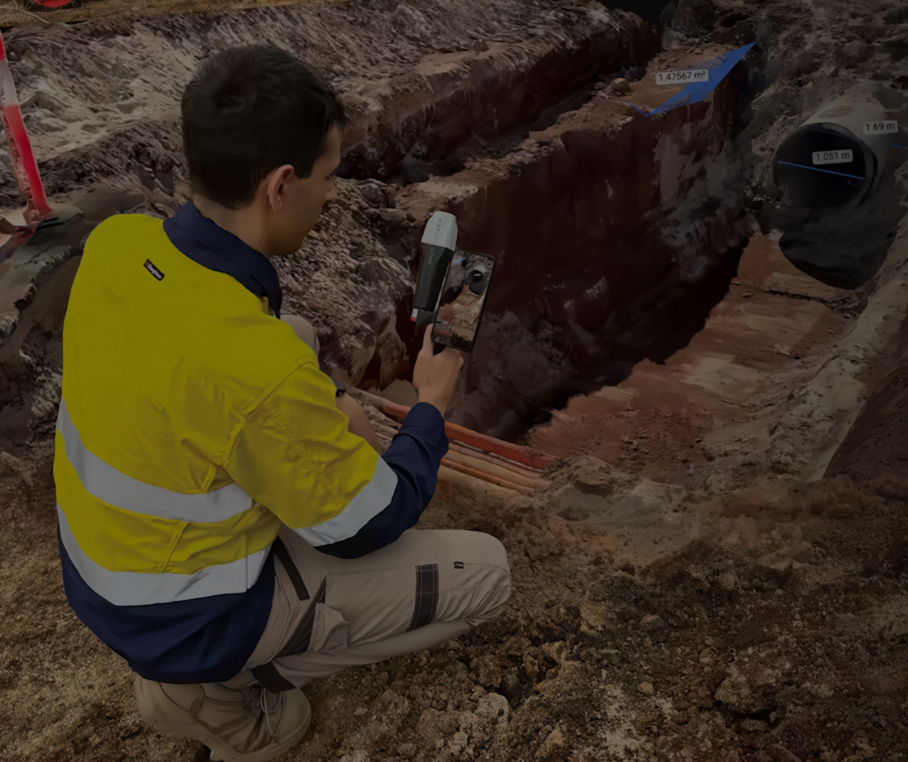
Imagine your field crews holding up a tablet or wearing smart glasses and “seeing” the precise location, depth, and orientation of every buried utility as if they had X-ray vision. This isn’t science fiction; it’s your new competitive advantage.
Compelling Cost Savings You Can Bank On
Adopting our AR visualization technology is a direct investment in your bottom line. Here’s the compelling evidence of how it reduces costs:
- Eradicate Costly and Dangerous Utility Strikes:
The most immediate saving is the prevention of the strike itself. By providing crews with millimeter-accurate 3D visualizations, you drastically reduce the risk of accidental damage. This eliminates the direct costs of repair, which can range from thousands to hundreds of thousands of dollars per incident. - Slash Project Delays and Accelerate Timelines:
Utility strikes trigger immediate work stoppages. The ensuing investigation, repair, and administrative processes can halt a project for days or weeks, leading to a cascade of expenses from idle crews, equipment rentals, and liquidated damages for missing deadlines. Our AR system allows for more efficient and confident excavation, keeping your projects on schedule and on budget. - Optimize Your Workforce and Reduce Labor Costs:
Studies have shown that AR tools can provide significant time savings. Utility locators can reduce the time to complete jobs by an average of 50%, saving 12-20 hours per locator per month. This productivity boost means your teams can accomplish more with the same resources, directly impacting your labor costs. By visualizing the entire utility layout, you can pre-plan excavation with surgical precision, reducing the time and expense of exploratory digging (“potholing”). - Prevent Rework and Improve Design Accuracy:
In the design and planning phase, AR is a powerful tool for identifying potential clashes between new infrastructure and existing utilities before construction begins. This proactive approach prevents costly redesigns and rework during the construction phase, saving both time and materials. - Lower Your Insurance Premiums and Legal Exposure:
A history of utility strikes directly impacts your insurance costs. By implementing our AR technology, you demonstrate a proactive commitment to risk management. This can lead to lower insurance premiums and reduces the likelihood of costly litigation and fines associated with utility damage.
The ROI is Clear: Dig Smarter, Not Harder
Investing in Subsurface Utility Engineering (SUE) has been shown to save over $4.50 in construction costs for every dollar spent. Our AR technology is the next evolution of this principle, maximizing the value of your SUE data by putting it directly into the hands of your field crews in a clear, intuitive, and actionable way.
In a world where precision is paramount, you can no longer afford to rely on outdated maps and guesswork. Our Augmented Reality Capture of Underground Utilities empowers your team to work smarter, faster, and safer.
Stop digging in the dark. Contact us today to schedule a demonstration and see how our AR technology can transform your operations and protect your profits