Project Progression Monitoring Keeping Stake Holders, Potential Leasers, and Financial Interests Informed
In the fast-paced world of commercial real estate, managing construction and renovation projects effectively while keeping all stakeholders aligned is a major challenge. Miscommunication, project delays, and the inability to clearly showcase progress can impact timelines and profitability.
TSI iGUIDE offers a powerful solution to these challenges by creating dimensionally accurate “digital as-builts” throughout the construction lifecycle. Our platform provides an intuitive and immersive way to monitor progress, enhance communication, and attract commercial tenants and buyers long before a project is complete. Click here to see how this works.
Our Construction-Focused Services Include:
Project Progress Monitoring
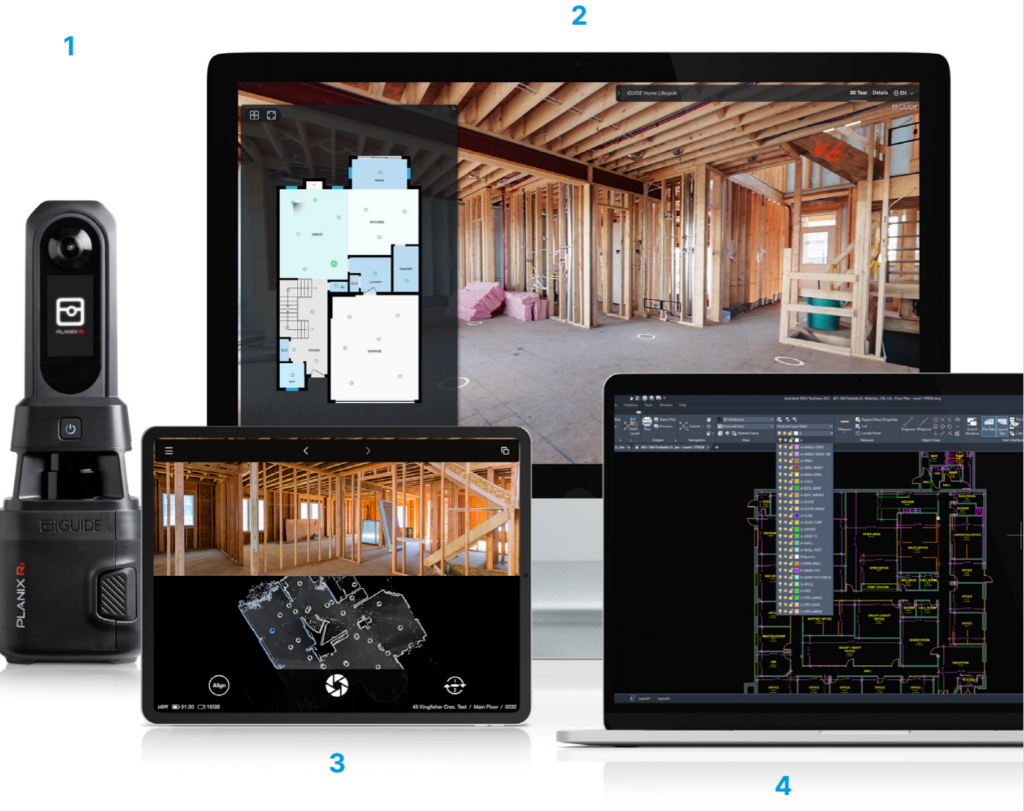
Keep stakeholders informed and your schedule on track with consistent weekly, semi-weekly or monthly aerial and ground based documentation. Our high-resolution imagery, 360 degree panos, and videos provide clear, up-to-date visuals from groundbreaking to final inspection.
We can provide detailed walk thru reality capture with annotations to insure contractor compliance and detailed visual proof of discrepancies that need corrective actions.
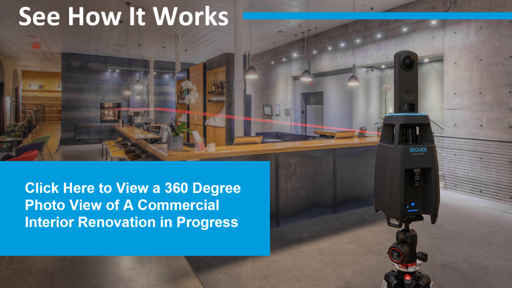
We can provide 360 degree panoramic photos of construction site walk thru inspections. You can click on the location based icons and the 360 photographic image will be presented for your viewing.
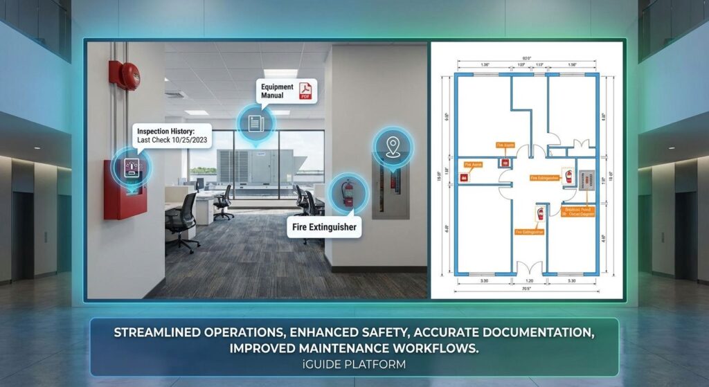
Mark Key Features, Fire Alarm Stations, Fire Extinguishers, Breaker Panels, Equipment Manuals, All Accessible Right From The Floor Plan
For facility managers and building owners, our platform is a game-changer for streamlining operations and enhancing safety. The true power lies in the ability to tag critical assets directly within the 3D virtual tour. Imagine the convenience of clicking on a tagged fire alarm station to view its inspection history, accessing an equipment manual for a rooftop HVAC unit from your desk, or instantly locating all fire extinguishers and electrical panels on a detailed floor plan. This interactive functionality provides a single source of truth for your building’s data, significantly improving maintenance workflows, and providing clear, accurate documentation for all stakeholders. Our LiDAR-based scans ensure dimensionally accurate floor plans, essential for space planning and renovation projects. Embrace the future of property management and marketing with a comprehensive, interactive, and intuitive solution that saves time, reduces costs, and provides invaluable insights into your building’s infrastructure.
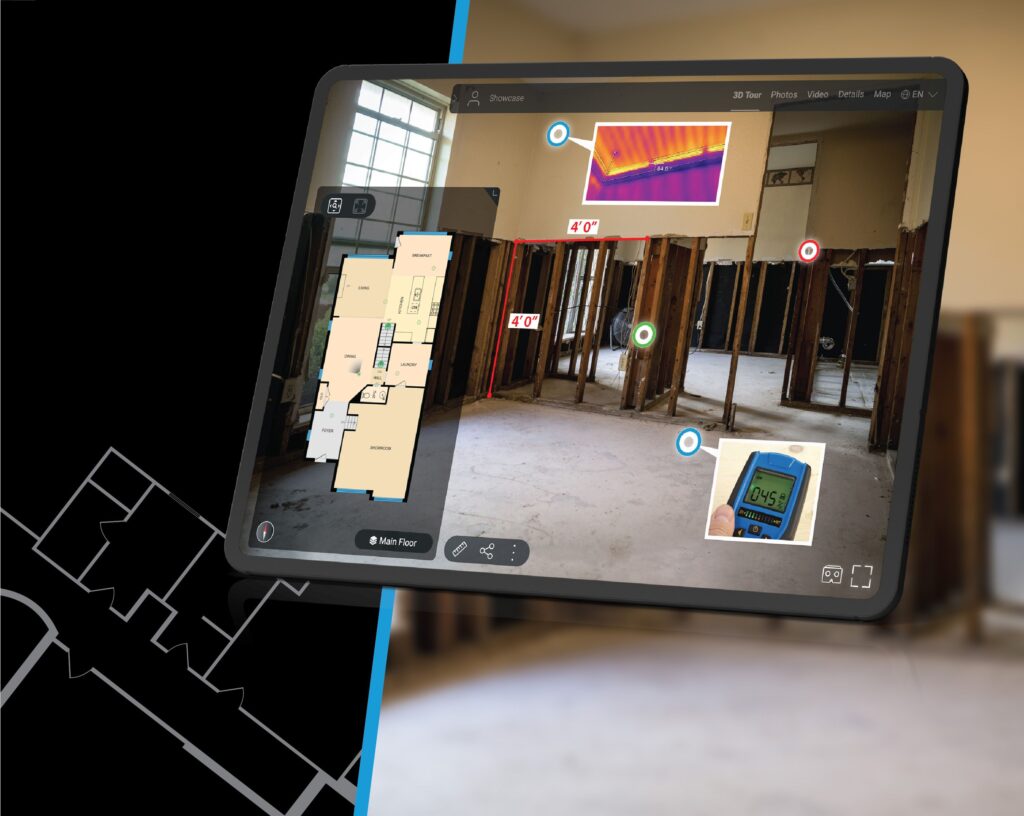
Place Tag Informational Markers Directly On the Images To Call Out Critical Information
iGUIDE’s tagging feature allows us to place precise digital markers directly on captured panoramic images, creating an efficient way to document and communicate key observations within a space. These tags can identify important elements such as breaker panels, HVAC systems, and other mechanical equipment, as well as highlight construction, insurance claim issues, safety concerns, or maintenance needs that require attention. By embedding detailed notes, photos, or links within each tag, iGUIDE makes it easy for project managers, inspectors, insurance adjusters, and stakeholders to access context-rich information in an intuitive, visual format—streamlining collaboration and improving the accuracy of site documentation.
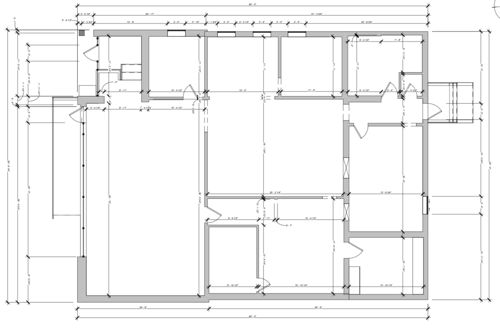
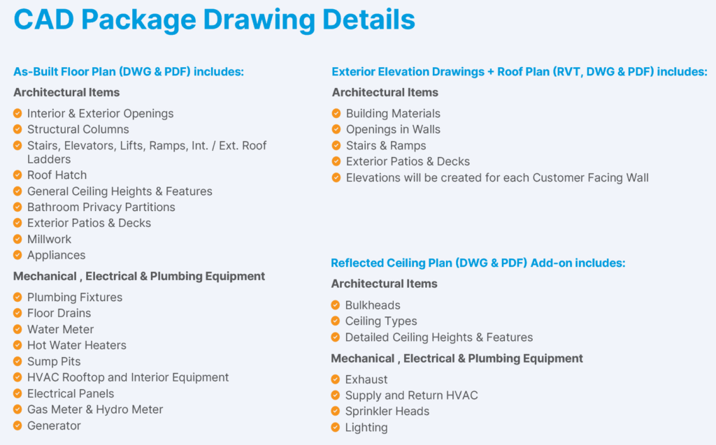
Detailed Floor Plans Delivered With Highly Accurate Dimensioned DWG Drawings
Win more projects and eliminate costly site re-visits with as-built documentation you can actually trust. Our iGUIDE-powered service delivers detailed floor plans together with highly accurate, fully dimensioned DWG files, giving architects and remodeling contractors a rock-solid starting point for design.
Instead of piecing together rough sketches, photos, and tape-measure notes, you get a complete, immersive virtual walkthrough plus the data-rich drawings you need to move straight into CAD. The Advanced Drawing Package combines iGUIDE’s premium 3D tour with professionally drafted floor plans (DWG), a detailed plotted drawing set, and lidar-based point cloud data for every floor (DXF). This means you can quickly validate conditions, explore options, and start designing with confidence—without going back on site.
Advanced Drawing Package
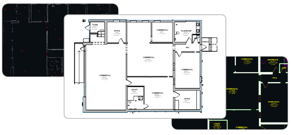
This package pairs iGUIDE’s Premium virtual walkthrough with a drafted floor plan (DWG), a detailed plotted drawing package and lidar point cloud data for all floors (DXF) to provide complete documentation of your property.
In the context of iGUIDE’s Advanced Drawing Package, a “plotted drawing set” refers to a comprehensive PDF file that compiles multiple as-built drawings into a print-ready, professionally formatted package. It typically includes detailed floor plans with surface-level MEP annotations (like breaker panels and mechanical equipment), dimensioned layouts plotted on sheets, and overlaid lidar point cloud visuals (horizontal and vertical sections for all floors). This deliverable provides architects and remodeling contractors with a polished, shareable document that’s ideal for client presentations, permitting, or on-site reference, distinct from editable DWG files or raw DXF point clouds
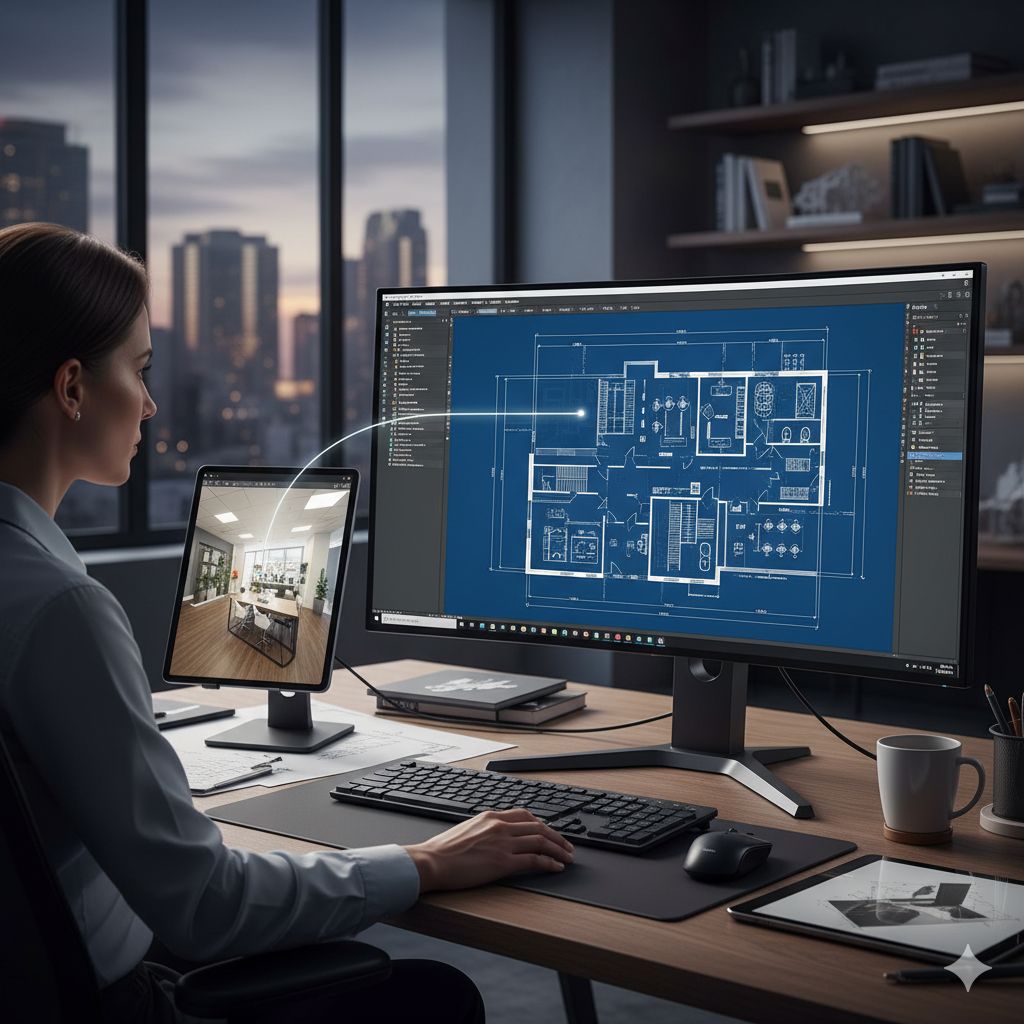
Our iGUIDE system offers a variety of advanced architecture solutions designed to enhance spatial visualization and project planning. With its immersive virtual walk throughs, detailed floor plans and accurate measurements, iGUIDE provides architects, designers and contractors with precise tools to speed up their CAD-based workflows.
For Architects & Contractors: Save Time, Save Money
Stop Measuring, Start Managing.
Are you still spending hours on site with a tape measure, notepad, and camera, hoping you’ve captured every detail? There’s a faster, more accurate, and more powerful way to work.
Technology Surveys & Inspections, powered by iGUIDE, transforms your entire project lifecycle, from initial concept to final handover.
As architect Chris Fernandes of CF Design explained, our service eliminates the biggest on-site pain points:
Verify As-Builts with Confidence: We provide a highly accurate Lidar point cloud that you can overlay directly onto your design drawings. Instantly spot deviations, confirm framing accuracy, and ensure construction perfectly matches your vision—before it becomes a costly problem.
Eliminate Costly Return Trips: With a complete, immersive 3D virtual tour, your entire job site is available 24/7 from your desktop. Resolve issues with subcontractors remotely, check on progress without driving to the site, and never miss a measurement again.
Create a Permanent “X-Ray” Record: Scan at key milestones—foundation, framing, and pre-drywall—to create an invaluable digital twin of the project. When the project is done, you can deliver a powerful asset to your client that shows them exactly where every pipe, wire, and stud is located behind the walls.
Streamline Communication & Enhance Client Experience: Share a single, easy-to-navigate link with clients, engineers, and trades. Everyone is on the same page, leading to faster decisions and a superior client experience that sets you apart.
Don’t just build it—document it with precision.
Contact Technology Surveys & Inspections today at (941) 356-4212 to schedule an iGUIDE scan and see how you can save time, reduce errors, and deliver unparalleled value on your next project.